Krafla
Volcano
Northeastern Region
65.737747,-16.827623
~3 hours
-
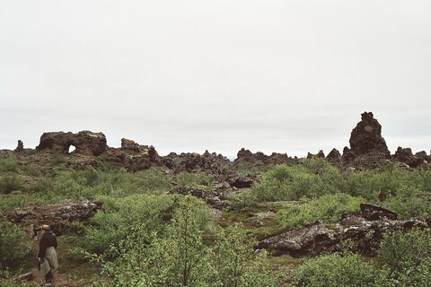
Krafla is a geothermal volcanic system situated in the Northeastern Region of Iceland. This rugged and dynamic landscape is known for its powerful geothermal activity, vibrant geothermal fields, and the Krafla caldera, which spans approximately 10 kilometers. Krafla's volcanic activity has shaped the region over millennia, resulting in an otherworldly terrain characterized by lava fields, steaming vents, and colorful mineral deposits.
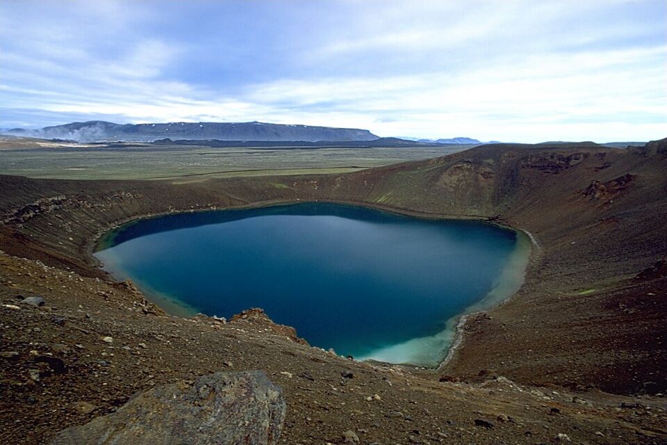
The area is home to several key features that captivate visitors. Leirhnjúkur, an active volcanic area in Krafla, is famous for its otherworldly scenes of bubbling mud pots, steaming fumaroles, and dramatic lava flows. The Víti crater, which translates to 'Hell,' is another prominent feature, showcasing a startling turquoise crater lake formed in the caldera after an eruption in 1724. Visitors can hike around the crater's rim for stunning views of the vibrant water juxtaposed against the rugged volcanic landscape.
Located in the Mývatn region, Krafla is easily accessible by road and offers numerous hiking trails that allow visitors to explore the geothermal phenomena up close. The area is about 17 kilometers northeast of the town of Reykjahlíð, making it a convenient stop for those touring the region.
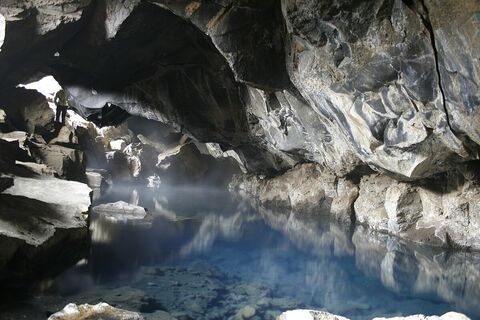
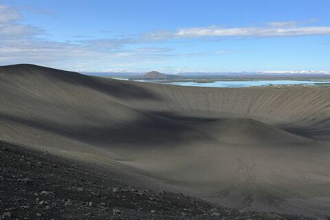
Nearby attractions include the Mývatn Nature Baths, often referred to as the 'Blue Lagoon of the North,' which provide a relaxing geothermal bathing experience. Additionally, the Hverir geothermal area offers more geothermal wonders with its boiling mud pools and steam vents. Together, these sites provide a comprehensive glimpse into Iceland's remarkable geothermal landscape.
Image of Krafla

Where is Krafla located?
Attractions near Krafla
Frequently asked questions
What is the best time to visit Krafla?
The best time to visit Krafla is during the summer months, from June to August, when the roads are open and the weather is milder. Winter visits are possible but require proper equipment and guidance due to snow and ice.
Do you need a 4x4 vehicle to access Krafla?
Yes, a 4x4 vehicle is recommended for visiting Krafla, especially if you're planning to explore the surrounding areas. Roads can be rugged, and a 4x4 provides better traction and control.
What unique geological features can you see at Krafla?
Krafla is famous for its geothermal power station and the expansive volcanic caldera. It features striking geothermal activity with bubbling mud pools, steaming vents, and the vivid turquoise waters of the Viti crater.
Are there any hiking trails around Krafla?
Yes, there are several hiking trails around Krafla that offer stunning views of the geothermal landscape. Popular hikes include the trail to the Viti crater and around Leirhnjukur, showcasing lava fields and sulfurous fumaroles.
Can you visit Krafla’s geothermal power station?
While the Krafla geothermal power plant itself is not open to the public, you can see its structures from the outside and learn more about geothermal energy in the region through information panels at key sites.
What should you bring when visiting Krafla?
It's advisable to bring windproof and waterproof clothing due to the area's variable weather conditions. Good hiking boots are necessary for navigating uneven terrain. Additionally, pack water, snacks, and a camera to capture the unique landscape.
Is Krafla suitable for everyone to explore?
While many parts of Krafla can be explored by visitors of all ages, some areas have rough and uneven terrain that may not be suitable for those with mobility issues. Caution is recommended on hiking trails, especially in adverse weather conditions.


