Hengifoss
Waterfall
Eastern Region
65.095181,-14.889634
~2 hours
-
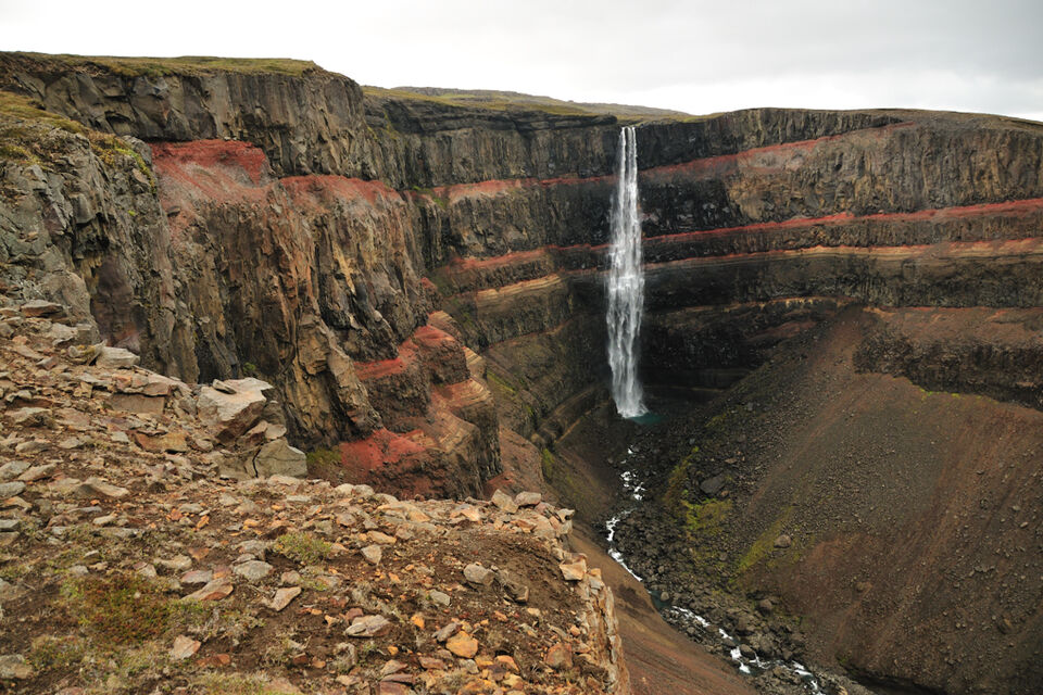
Hengifoss is a magnificent waterfall nestled in the Eastern Region of Iceland. Dropping from a height of 128 meters, Hengifoss is Iceland's third highest waterfall and captivates visitors with its stunning beauty and geological significance. The red strata of clay sandwiched between layers of basalt rock add a unique, colorful touch to the cliff face, making it a striking natural spectacle.
The waterfall’s layered rock formations tell a fascinating story of Iceland's volcanic history. Each stratum represents different volcanic eruptions and periods, offering a geological timeline that attracts geologists and enthusiasts alike. The cascading waters fall into a serene pool below, creating a picturesque scene that draws photographers and nature lovers from around the world.
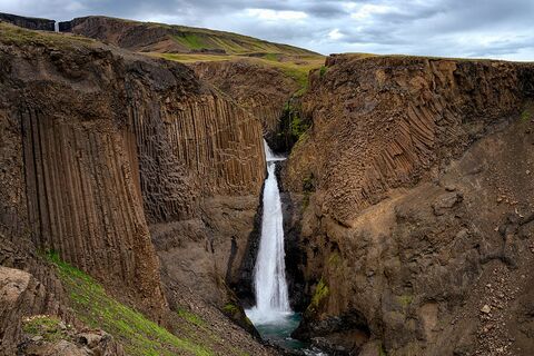
Hengifoss is located near Lagarfljót, a long and narrow glacial lake known for its legends and tranquil beauty. The waterfall is accessible via a well-marked hiking trail that starts near the lake, making it a popular spot for hikers. The trail to Hengifoss also takes you past another beautiful waterfall, Litlanesfoss, characterized by its striking basalt column formations.
In the vicinity, visitors can explore the charming town of Egilsstaðir, the largest settlement in eastern Iceland. The Hallormsstaður National Forest, Iceland's largest forest, and the mystical Lagarfljót lake, rumored to be home to a serpent-like creature, provide additional attractions in the area.
Image of Hengifoss

Where is Hengifoss located?
Hengifoss ➤ 65.095181,-14.889634
Parking 1 ➤ 65.073315,-14.880660
Attractions near Hengifoss
Frequently asked questions
Is a hike necessary to reach Hengifoss?
Yes, reaching Hengifoss requires a hike. The trail is about 2.5 km (1.5 miles) each way, with a moderate ascent, taking approximately 45 minutes to an hour.
When is the best time to visit Hengifoss?
The best time to visit Hengifoss is during the summer months, from June to August, when the trail is easily accessible and the weather conditions are most favorable.
How does Hengifoss stand out among other Icelandic waterfalls?
Hengifoss is unique due to its striking red and orange clay layers sandwiched between basaltic lava strata. At 128 meters (420 feet), it is one of Iceland's tallest waterfalls, offering a stunning visual contrast in its rock formations.
Are there any facilities at Hengifoss?
There are basic facilities at the Hengifoss car park, including restrooms and informative signage. It's advisable to bring water and snacks, as there are no food services available on-site.
How long does it take to drive to Hengifoss from Egilsstaðir?
The drive from Egilsstaðir to Hengifoss takes about 30 minutes, covering a distance of roughly 35 km (22 miles) along Route 933.
Can you explore other attractions in the area?
Yes, nearby attractions include Lagarfljót lake, known for its folklore, and the Hallormsstaður National Forest, which is Iceland’s largest forest offering various hiking trails.
What should visitors be aware of when planning a trip to Hengifoss?
Visitors should be prepared for changing weather conditions and wear appropriate hiking gear. The trail can be slippery, particularly after rain, so sturdy hiking boots are recommended.


