Námaskarð
Geothermal Area
Eastern Region
65.655902,-15.009192
~2 hours
-
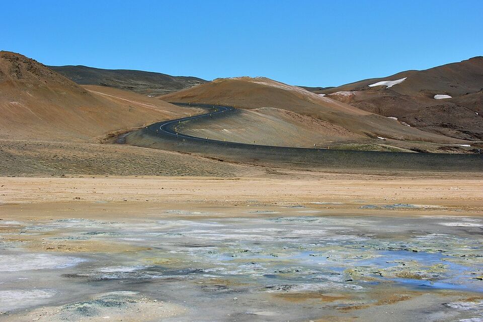
Námaskarð is a fascinating geothermal area located in Iceland's Northeast Region. This geothermal field is renowned for its steaming vents, boiling mud pots, and sulfur deposits, creating a vividly colorful and otherworldly landscape. The area is part of the larger Krafla volcanic system, contributing to its geothermal activity and unique geological features.
The key features of Námaskarð that make it unique include the intensely vibrant hues of the earth, ranging from deep reds to bright yellows, due to the high sulfur content. Visitors can marvel at the seething mud pots and hissing steam vents that offer an up-close look at the powerful geothermal forces at work beneath the Earth's surface. Walking paths are specially designed to guide visitors safely through this dynamic and ever-changing landscape.
Situated on the eastern side of Lake Mývatn, Námaskarð is easily accessible and is a must-see stop on any tour of Iceland's Ring Road. The area is not only a geological wonder but also an important historical site, as sulfur was mined here in the past, giving Námaskarð its name, which means ‘mine pass’ in Icelandic.
Nearby attractions include the Krafla volcanic area, where you can explore the impressive Viti Crater, and the Hverfjall crater, a stunning tephra cone with panoramic views of the surrounding landscapes. Additionally, the Mývatn Nature Baths offer a relaxing geothermal spa experience, perfect for unwinding after exploring the dynamic terrains of Námaskarð.
Image of Námaskarð
Where is Námaskarð located?
Námaskarð ➤ 65.655902,-15.009192
Parking 1 ➤ 65.655230,-15.009503
Attractions near Námaskarð
Frequently asked questions
What is the best way to get to Námaskarð?
Námaskarð is located near Lake Mývatn in North Iceland. You can reach it via Route 1, and the area is accessible by regular car during the summer. During winter months, road conditions can vary, so checking weather and road updates is advisable.
When is the best time to visit Námaskarð?
The ideal time to visit Námaskarð is during the summer months from June to August, when the roads are clear and the daylight is extended. Winter visits are possible but may require more preparation due to weather conditions.
What are the main attractions at Námaskarð?
Námaskarð is famous for its geothermal features, including fumaroles, mud pots, and hissing steam vents. The colorful terrain, with vibrant yellow, orange, and red hues, makes for spectacular photography opportunities.
Are there any safety precautions to take at Námaskarð?
Yes, it's essential to stay on the marked paths to avoid fragile ground around the geothermal areas. The steam and fumes can be hot and potentially harmful, so keep a safe distance from active vents.
Are there facilities available at Námaskarð?
Námaskarð itself does not have visitor facilities, but nearby locations such as Lake Mývatn have restaurants, accommodation, and restroom facilities available for visitors.
Can you combine a trip to Námaskarð with other attractions?
Yes, Námaskarð is close to various other attractions in the Mývatn area, such as the Mývatn Nature Baths, Dimmuborgir lava fields, and the Krafla volcanic area, making it ideal for a day trip or extended visit.
Is the smell at Námaskarð overwhelming?
The geothermal activity at Námaskarð produces sulfur fumes, which have a strong rotten egg smell. While the odor can be intense, most visitors find it tolerable, but those sensitive to strong smells may want to limit their exposure.
