Merardalaleið - Path D (7km)
Hiking
Southern Peninsula
63.858326,-22.278000
~4 hours
-
Merardalaleið - Path D (7km) is a scenic hiking trail in Iceland that offers an immersive experience in the rugged beauty of the Reykjanes Peninsula. This 7-kilometer path takes hikers through diverse landscapes, including lava fields, geothermal areas, and picturesque coastal views.
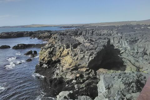
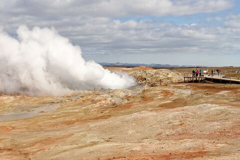
The key features of Merardalaleið - Path D include its striking geothermal areas where you can witness steam vents and bubbling mud pools, remnants of the peninsula's volcanic activity. The trail also crosses ancient lava fields, giving hikers a close look at the hardened, blackened surfaces shaped by past eruptions. The coastal sections provide stunning views of the North Atlantic Ocean, with dramatic cliffs and the sound of crashing waves adding to the location's allure.
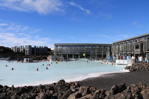
Located in the southwestern part of Iceland, the trail begins near the town of Grindavík, making it accessible to travelers coming from Reykjavík, which is only about a 45-minute drive away. The trail's proximity to the Blue Lagoon, one of Iceland's most famous attractions, allows for a relaxing soak in the famous geothermal spa after a day of hiking.
Nearby, you can also explore the Reykjanesviti Lighthouse, Iceland's oldest lighthouse, and the Bridge Between Continents, a symbolic bridge spanning the Eurasian and North American tectonic plates. These attractions, combined with the natural beauty of the Merardalaleið trail, make this region a must-visit for nature lovers and adventure seekers.
Where is Merardalaleið - Path D (7km) located?
Download GPX file
Merardalaleið - Path D (7km) ➤ 63.858326,-22.278000
Attractions near Merardalaleið - Path D (7km)
Frequently asked questions
Do you need a 4x4 to access Merardalaleið - Path D?
Yes, a 4x4 vehicle is recommended to reach the starting point of Merardalaleið - Path D, as the terrain can be rough and some roads leading to it are gravel and might be challenging for standard vehicles.
When is the best time to hike Merardalaleið - Path D?
The best time to hike Merardalaleið - Path D is during the summer months, from June to September, when the weather is milder and the trail is more accessible. Winter conditions can make the path difficult to navigate.
How long does it take to hike Merardalaleið - Path D?
The hike typically takes about 2 to 3 hours to complete, depending on your pace and weather conditions. Ensure you allocate extra time for breaks and photo opportunities.
What are the unique features of Merardalaleið - Path D?
Merardalaleið - Path D is famous for its stunning landscapes, including volcanic formations and panoramic views of surrounding mountains and valleys. The path offers a chance to experience Iceland's rugged beauty up close.
Is Merardalaleið - Path D suitable for beginners?
The path is moderately challenging and best suited for hikers with some experience. Beginners should take caution, especially on steeper sections, and ensure they have appropriate footwear and navigation devices.
Are there facilities along Merardalaleið - Path D?
There are no facilities directly on the trail, so hikers should come prepared with adequate water, snacks, and appropriate clothing for varying weather conditions. The closest amenities are often found in nearby towns or villages.
Are there other notable trails or landmarks near Merardalaleið - Path D?
Yes, the region offers a variety of trails and natural attractions. You may want to explore nearby lava fields or other hiking paths that showcase Iceland's unique geological features. Check local maps and guides for additional options.


