Stóra Grábrók
Volcano
Western Region
64.771450,-21.538719
~2 hours
-
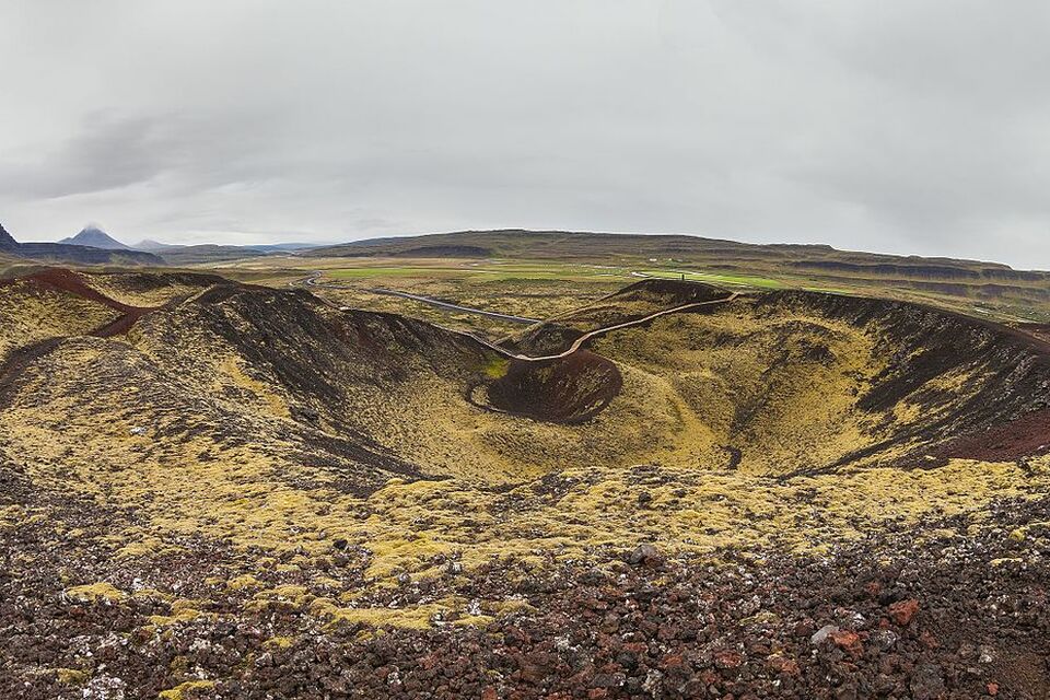
Stóra Grábrók is an impressive crater volcano located in Western Iceland, near the town of Bifröst. This volcanic site is part of the Grábrók craters and offers a magnificent example of Iceland's unique geothermal activity and volcanic landscape. The crater, formed approximately 3,000 years ago during a fissure eruption, stands about 170 meters above sea level and provides panoramic views of the surrounding area.
One of the key features of Stóra Grábrók is its hiking trail which allows visitors to climb to the top of the crater. The well-maintained path includes steps and viewing platforms that make the ascent accessible while minimizing impact on the fragile volcanic terrain. From the summit, hikers are rewarded with stunning views over the Borgarfjörður region, Hreðavatn lake, and neighboring smaller craters, creating a picturesque landscape that captures the raw beauty of Icelandic nature.
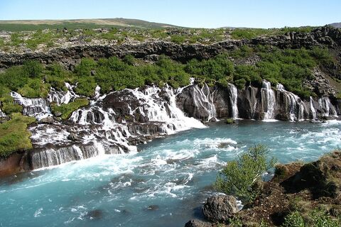
Situated just off Route 1, Iceland's main ring road, Stóra Grábrók is conveniently located, making it an ideal stop for travelers exploring the Western Region. Nearby, visitors can explore Deildartunguhver, Europe's highest flow hot spring, the historical site of Reykholt, and the enchanting Hraunfossar and Barnafoss waterfalls, all offering further opportunities to experience the natural and cultural heritage of Iceland.
Image of Stóra Grábrók

Where is Stóra Grábrók located?
Attractions near Stóra Grábrók
Frequently asked questions
Do you need a special vehicle to visit Stóra Grábrók?
No, you do not need a special vehicle to visit Stóra Grábrók. The site is easily accessible by car as it is located just off Route 1, the Ring Road, near Bifröst.
When is the best time to visit Stóra Grábrók?
The best time to visit Stóra Grábrók is during the summer months, from June to September, when the weather is mild, and the walking paths are clear. However, it's accessible year-round, with winter visits offering a quieter experience.
What can you do at Stóra Grábrók?
Visitors can enjoy hiking up volcanic craters and walking along the designated paths to explore the unique volcanic landscape. The hike offers panoramic views of the surrounding lava fields and mountains.
Are there any entrance fees for Stóra Grábrók?
No, there are no entrance fees to visit Stóra Grábrók. It is open to the public and free of charge.
What makes Stóra Grábrók unique?
Stóra Grábrók stands out for its accessible volcanic craters, which are remnants of a volcanic eruption over 3,000 years ago. The well-maintained paths offer an easy hike with stunning vistas over the ancient lava fields.
How long does it take to reach Stóra Grábrók from Reykjavík?
It takes approximately 1.5 to 2 hours to drive from Reykjavík to Stóra Grábrók, depending on traffic and weather conditions.
Are there any amenities available at Stóra Grábrók?
While there are no facilities directly at the site, there are restrooms and a café nearby at the Bifröst service station. It is advisable to bring water and snacks if you're planning a longer visit.


