Glymur
Waterfall
Western Region
64.391012,-21.251517
~4 hours
-
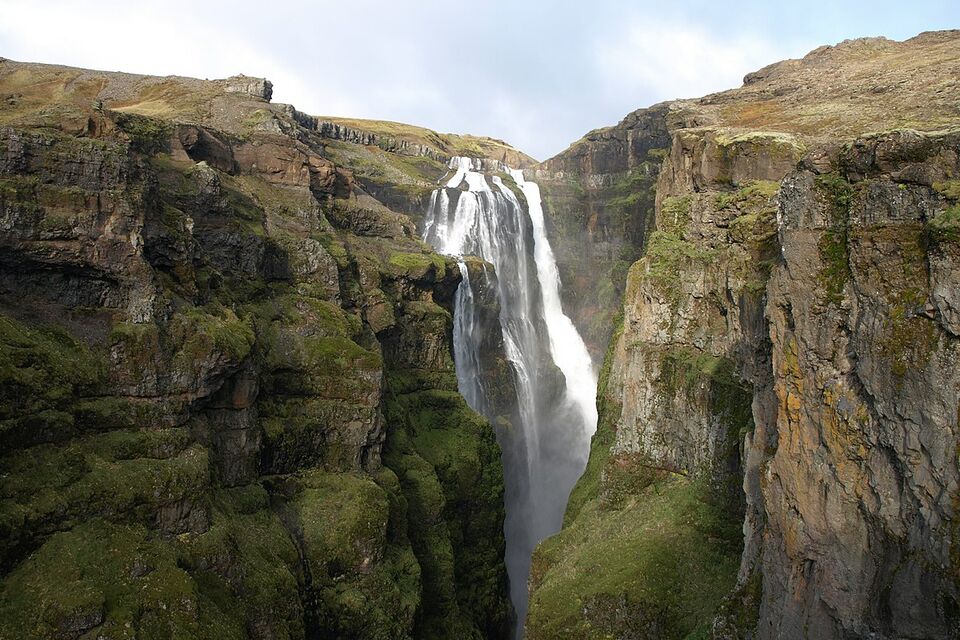
Glymur is a majestic waterfall nestled in Iceland's Hvalfjörður fjord. As the second-tallest waterfall in Iceland, it plunges an awe-inspiring 198 meters down a lush, moss-covered canyon, making it a must-see destination for hikers and nature lovers. Glymur was previously considered the tallest waterfall in Iceland until the discovery of Morsárfoss.
The sheer height of Glymur is just one of its many remarkable characteristics. To reach the waterfall, visitors embark on a challenging yet rewarding hike that includes river crossings, navigating through a cave, and trekking across varied terrains. The journey provides spectacular views of the surrounding landscapes, characterized by rich green moss, rugged cliffs, and the serene Botnsa River that feeds the falls.
Located in the western region of Iceland, Glymur is about an hour's drive from Reykjavik, making it a perfect day trip for those staying in the capital. The trailhead starts at the end of a gravel road, with signage guiding hikers through the picturesque journey.
After exploring Glymur, visitors can take advantage of the nearby attractions such as the scenic Hvalfjörður fjord itself, known for its tranquil beauty and historical significance, and the Viðgelmir Lava Cave, one of the largest and most spectacular lava caves in Iceland. These attractions offer diverse and enriching experiences, making the region a fascinating area for adventurers.
Image of Glymur

Where is Glymur located?
Attractions near Glymur
Frequently asked questions
Do you need a 4x4 to reach Glymur Waterfall?
No, a 4x4 vehicle is not necessary to reach Glymur Waterfall. The trailhead is accessible by car via Route 47; however, some sections of the road can be gravel, so drive cautiously.
When is the best time to visit Glymur Waterfall?
The best time to visit Glymur is during late spring to early autumn (May to September) when the trails are clear of snow. During this period, you can fully enjoy the hiking experience and the beautiful views without weather constraints.
What makes Glymur Waterfall unique?
Glymur was once considered Iceland's tallest waterfall, with water cascading down 198 meters (650 feet). Its hike offers spectacular views of the Hvalfjörður fjord and a challenging yet rewarding trail featuring a natural cave and river crossing.
How long is the hike to Glymur Waterfall?
The hike to Glymur Waterfall typically takes around 3 to 4 hours round trip, depending on pace and trail conditions. The trail features some steep and challenging sections, so be prepared for a moderately difficult hike.
Are there any river crossings on the Glymur hike?
Yes, the hike to Glymur includes a river crossing, usually done via a log and rope setup. It’s advisable to wear waterproof shoes or bring an extra pair of socks to manage the crossing comfortably.
Can you reach the top of Glymur Waterfall?
Yes, there is a hiking route that takes you above Glymur Waterfall for a stunning panoramic view. The trail is steep and requires extra caution, particularly on wet or slippery days, so ensure you're equipped with proper hiking shoes.
Is hiking to Glymur Waterfall safe for families?
While families can enjoy the hike, it's important to note that sections of the trail require crossing streams and steep paths. The hike is best suited for families with older children who are accustomed to such conditions.


