Kerið
Volcano
Southern Region
64.040930,-20.884602
~30 minutes
-
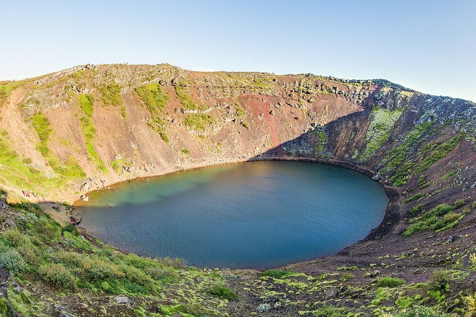
Kerið is a fascinating volcanic crater lake located in Iceland's Grímsnes area in South Iceland. This natural marvel is part of the area's renowned Tjarnarhólar cluster of volcanic hills, formed around 3,000 years ago. Kerið is famous for its striking appearance: the caldera has vivid red volcanic rock and slopes gently downward, creating a stunning contrast with the vibrant, aquamarine waters within the crater.
Key features of Kerið include its unique oval-shaped caldera, which is approximately 55 meters deep, 170 meters wide, and 270 meters across. Unlike many volcanic craters that are formed by explosive eruptions, Kerið was shaped by a collapsing magma chamber after a volcanic eruption. The lake inside, about 7-14 meters deep depending on rainfall, offers an ever-changing spectacle as the water level fluctuates with the seasons.
Kerið is situated along the scenic Golden Circle route, making it easily accessible to travelers exploring South Iceland. This prime location allows visitors to enjoy a hike around the rim of the crater or descend into the caldera to get closer to the serene lake. The surrounding landscape, with its lush vegetation and panoramic views, adds to the site's enchanting appeal.
Nearby attractions include the renowned Geysir geothermal area, historical Þingvellir National Park, and the majestic Gullfoss Waterfall.
Image of Kerið

Where is Kerið located?
Kerið ➤ 64.040930,-20.884602
Parking 1 ➤ 64.041536,-20.886984

