Þingvallavatn
Lake
Southern Region
64.189939,-21.150055
-
Þingvallavatn is Iceland's largest lake, located in the Southern Region within the Þingvellir National Park. This expansive and pristine lake spans approximately 84 square kilometers (32 square miles) and reaches depths of up to 114 meters (374 feet). Þingvallavatn is renowned for its crystal-clear waters and its significant geological and historical importance.
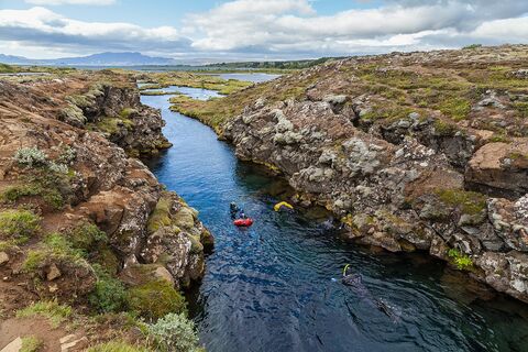
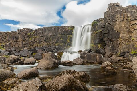
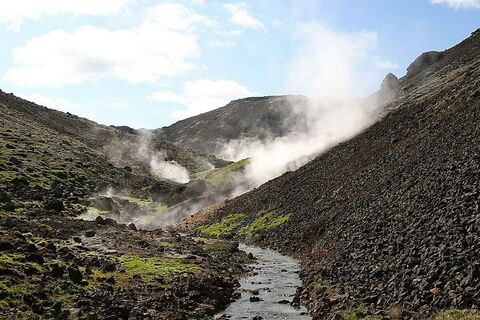
The lake sits in a rift valley, formed by the divergent boundary between the North American and Eurasian tectonic plates. The surrounding landscape offers breathtaking views of volcanic formations, rugged lava fields, and rolling hills. The lake's clarity allows for excellent visibility of underwater features, making it a popular destination for diving and snorkeling enthusiasts. The unique geological setting of Þingvallavatn also contributes to its fascinating underwater geology, including submerged lava formations and fissures.
Þingvallavatn is historically significant as well, being located within the Þingvellir National Park, which is recognized as a UNESCO World Heritage Site for its role in Iceland's early parliament, the Alþingi, established in 930 AD. Visitors can explore the park's rich cultural heritage and enjoy scenic walks around the lake, offering opportunities to observe local wildlife and enjoy the serene natural beauty.
Nearby attractions include the dramatic Silfra fissure, known for its exceptional diving experiences, and the striking Almannagjá canyon. Þingvallavatn provides a perfect blend of natural splendor and historical significance, making it a must-visit destination for anyone exploring Iceland's diverse landscapes.
Where is Þingvallavatn located?
Attractions near Þingvallavatn
Frequently asked questions
Is Þingvallavatn accessible by car?
Yes, Þingvallavatn is accessible by car via Route 36, which connects to the main Ring Road. The site is within Þingvellir National Park, with ample parking available near key viewpoints and amenities.
When is the best time to visit Þingvallavatn?
The best time to visit Þingvallavatn is during late spring to early autumn (May to September) when the weather is milder, and activities like hiking and kayaking are more enjoyable.
Can you swim or dive in Þingvallavatn?
Yes, Þingvallavatn is popular for snorkeling and diving, particularly in the Silfra fissure, offering a unique experience of swimming between the North American and Eurasian tectonic plates. However, the water is cold year-round, so wearing a drysuit is essential.
What unique features does Þingvallavatn offer?
Þingvallavatn is Iceland's largest natural lake, known for its crystal-clear waters and geological significance. The combination of stunning volcanic landscapes and historical significance in Þingvellir National Park adds to its allure.
Are there hiking trails around Þingvallavatn?
Yes, several hiking trails are available around Þingvallavatn, offering scenic views of the lake and surrounding landscape. Trails range from easy walks to more challenging routes, and information is available at the park's visitor center.
Is Þingvallavatn suitable for families with children?
Yes, Þingvallavatn is suitable for family visits, with accessible trails and picnic areas. However, tread carefully near water edges and follow park guidelines to ensure a safe visit.
Are there accommodation options near Þingvallavatn?
Yes, accommodations range from campgrounds to hotels and guesthouses in and around Þingvellir National Park. Early booking is recommended, especially during peak tourist seasons.


